Krakatau (Krakatoa)

Full Text / Article Transcript 
The Loudest Sound Ever Heard:
Krakatau Awakens Again in a Restless Indonesian Archipelago
Albert N. Clark
Independent Author
Published: September 13, 2026
ASX Research Journal and Database
ISSN 3068-3351 (Online)
Place of Publication: Cadiz City, Philippines
Publisher: ASXResearch.org
Author Note
Albert N. Clark
Department of Aerospace Sciences, ASXResearch.org
ORCID iD: https://orcid.org/0009-0002-7348-4395
The author reports no conflicts of interest.
Correspondence concerning this article should be addressed to Albert N. Clark, Email: [email protected]
Abstract
Krakatau occupies a singular position in volcanic history as the source of the loudest sound ever recorded and one of the most devastating volcanic disasters of the modern era. Today, its successor, Anak Krakatau, is again exhibiting significant unrest within Indonesia’s exceptionally active tectonic environment. This study examines the evolution of the Krakatau volcanic system from the catastrophic 1883 eruption through the deadly 2018 flank collapse and tsunami to the renewed eruptive, seismic, and magmatic activity observed in 2026. Particular attention is given to deep magma movement, sustained and Strombolian eruptions, sulfur dioxide emissions, regional seismicity, possible earthquake–volcano interactions, structural instability, aviation disruption, and the continuing potential for volcanogenic tsunami generation. Current evidence does not support claims of a regional volcanic chain reaction or demonstrate that recent deep-focus earthquakes triggered Anak Krakatau’s activity; however, the convergence of persistent magma recharge, rapid edifice reconstruction, gravitational instability, and continuing eruption creates a complex multi-hazard environment. The greatest future danger may therefore not be another repetition of 1883, but an entirely different sequence involving eruption, structural failure, flank collapse, and tsunami. Krakatau’s history demonstrates that its next major hazard need not resemble its last—and the child of the loudest sound ever heard remains profoundly alive.
Keywords: Anak Krakatau; volcanic hazards; volcanogenic tsunami
The Loudest Sound Ever Heard:
Krakatau Awakens Again in a Restless Indonesian Archipelago
On August 27, 1883, Krakatau did something humanity had never instrumentally experienced on such a scale: it announced its destruction across an appreciable fraction of the planet. The climactic explosions were heard thousands of kilometers away, atmospheric pressure waves repeatedly circled Earth, much of the volcanic island disappeared, and tsunamis devastated the coasts of Java and Sumatra. Contemporary estimates place the death toll at roughly 36,000, overwhelmingly from the sea rather than the sound itself. The event remains recognized as the loudest sound in recorded history, but its scientific importance is greater than that superlative suggests: Krakatau demonstrated that one volcanic system can simultaneously couple the solid Earth, ocean and atmosphere into a cascading catastrophe (Latter, 1981).
The monster did not disappear. Beginning in the late 1920s, a new cone emerged from the submerged 1883 caldera and acquired the appropriately ominous Indonesian name Anak Krakatau—“Child of Krakatau.” It subsequently grew through repeated eruptions into a remarkably active volcanic island. Its plumbing is not simply a shallow vat of molten rock waiting beneath the crater: petrological evidence indicates multiple magma-storage regions extending through the crust, while more recent work suggests Anak Krakatau magma can be stored at depths approaching roughly 26 kilometers (Dahren et al., 2012; Pratama et al., 2023). The volcano visible above the Sunda Strait is therefore merely the surface expression of a vertically extensive magmatic system.
Then, on December 22, 2018, Anak Krakatau demonstrated why concentrating exclusively on explosive magnitude is a potentially fatal mistake. After months of eruptive activity, much of its southwestern flank failed and plunged into the sea. The collapse generated a tsunami without the large tectonic earthquake normally associated with Indonesian tsunami warnings. More than 400 people died along the Sunda Strait, thousands were injured, and coastal communities received essentially no conventional earthquake warning because there had been no great earthquake to warn them about. Walter et al. (2019) reconstructed a complex precursor sequence involving thermal anomalies, growth of the island and progressive seaward displacement of the unstable flank; Grilli et al. (2019) independently modeled the lateral collapse and resulting tsunami. Krakatau had rediscovered one of its most lethal weapons: gravity.
The physical dimensions of that failure are sobering. Marine surveys subsequently revealed enormous submarine landslide blocks and concluded that approximately half of the island failed during the 2018 event (Hunt et al., 2021). Field observations recorded tsunami runup reaching approximately 13.5 meters on populated coastlines, while much larger runups occurred on islands close to the volcano (Muhari et al., 2019). Numerical reconstruction indicates that roughly 0.24 cubic kilometers of material entering the sea over only several minutes could have generated waves exceeding 40 meters near their source (Mulia et al., 2020). The lesson is crucial to the present unrest: Anak Krakatau does not require another 1883-scale explosion to kill people tens of kilometers away. It needs only enough unstable volcano to fall into enough water quickly enough.
That distinction becomes especially important in 2026 because Anak Krakatau is rebuilding. Meredew et al. (2026) reconstructed the volcano's historical edifice evolution specifically to forecast future instability and concluded that the post-2018 cone has undergone rapid regrowth. Stoepke et al. (2025), using direct-shear experiments and finite-element modeling, found that deformation can be controlled by a weak internal shear plane and that Anak Krakatau material can weaken as sliding velocity increases—a mechanical characteristic that matters enormously once flank movement begins. Neither study predicts that another collapse is imminent. Together, however, they destroy the comforting assumption that 2018 “reset” the volcano and eliminated its flank-collapse hazard. It reset the clock; it did not remove the clock.
That clock began ticking noticeably louder again in June 2026. Indonesian Geological Agency observations detected sulfur-dioxide emissions and thermal anomalies beginning in June, and renewed eruption on July 2 prompted authorities to raise Anak Krakatau from Level II (Waspada) to Level III (Siaga), Indonesia's second-highest volcanic alert level. The exclusion radius was set at three kilometers. This renewed activity is consistent with a volcano whose recent eruptive products record multiple explosive mechanisms: Wibowo et al. (2026) identified magmatic Vulcanian and Strombolian activity in Anak Krakatau deposits and emphasized that significant variations in explosivity can occur within a comparatively narrow basaltic-andesite compositional range. In other words, similar magma does not guarantee similar behavior.
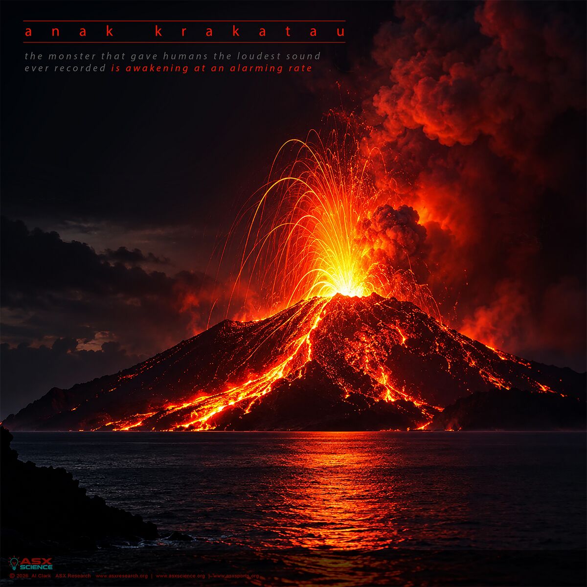
The system escalated dramatically on September 4. At 23:07 Western Indonesian Time, instruments recorded the beginning of a continuous eruptive episode that persisted for approximately 25 hours, producing sustained incandescent activity and lava-fountain behavior before ending shortly after midnight on September 6. Ash eventually reached aviation altitudes approaching 50,000 feet, eight airports suspended operations, and the disruption ultimately affected hundreds of thousands of passengers and thousands of flights. All affected airports subsequently reopened as atmospheric conditions improved, but the episode demonstrated that Anak Krakatau can inflict continental-scale transportation consequences without approaching anything resembling its ancestor's 1883 violence. Modern civilization has given the volcano targets Krakatau could not attack in 1883: jet engines, international hubs, tightly coupled airline networks and supply chains (Wilson et al., 2026).
The eruption did not simply stop when the 25-hour episode ended. Anak Krakatau shifted into intermittent Strombolian activity, with repeated explosions throwing incandescent material and ash from the crater. By September 11, Indonesian authorities had recorded 14 subsequent Strombolian eruptions. More intriguing was the seismic pattern beneath them: monitoring between September 10 and 11 recorded one eruption earthquake, 21 low-frequency events, 13 hybrid events, 28 shallow volcanic earthquakes, 18 deep volcanic earthquakes and continuous tremor. Shallow volcanic seismicity was trending downward while deeper volcanic earthquakes increased. That is not evidence that catastrophe is approaching, but neither is it the signature of a dead system. It is consistent with continuing magma supply beneath an erupting volcano.
Then Earth added another variable. Early on September 12, a powerful deep-focus earthquake occurred in the broader region. Different seismic networks produced different magnitude and location solutions, but the essential fact is its extraordinary depth—hundreds of kilometers beneath the surface. On the Pulse with Silki (2026) correctly emphasizes the point that gets lost on two-dimensional maps: an epicenter that appears disturbingly close to Anak Krakatau is not equivalent to an earthquake rupturing beneath its magma reservoir. Once hypocentral depth is incorporated, the earthquake source and volcanic plumbing system are separated by hundreds of kilometers. The earthquake therefore did not rupture Anak Krakatau's magma chamber, and its great depth made significant tsunami generation from seafloor displacement implausible.
That does not make the earthquake scientifically irrelevant. Large earthquakes send dynamic stresses through immense volumes of crust and mantle, and those transient seismic waves can perturb volcanic systems far from the rupture. Seropian et al. (2021) found that earthquake-triggered volcanic unrest is physically plausible but that actual triggered eruptions are comparatively rare and generally require a volcanic system already close to instability. Sulpizio and Massaro (2022) similarly concluded that the volcano must effectively be ready to erupt and the earthquake capable of imposing a sufficient perturbation. Anak Krakatau satisfies at least the uncomfortable half of that equation: it was already erupting, degassing, trembling and receiving magma before the September 12 earthquake occurred.
This is where chronology saves us from sensationalism. The earthquake cannot have caused the 2026 Anak Krakatau crisis because the crisis preceded it by months; it cannot have initiated the major September eruption because that eruption began approximately a week earlier. The scientifically legitimate question is narrower and considerably more interesting: did seismic waves from the earthquake perturb an already pressurized magmatic system? Silki's own post-earthquake analysis reports no immediate explosive step-change in the first publicly available monitoring data and explicitly acknowledges that detailed waveform, deformation and gas measurements would be necessary to demonstrate a subtle response. This is exactly where provocative science must remain disciplined: temporal proximity creates a hypothesis, not causation.
The current Indonesian picture is nevertheless extraordinary. Multiple volcanoes have erupted or shown elevated activity across the archipelago in a compressed period, producing the visual impression that Indonesia itself is switching on. But there is presently no credible evidence of a domino-like volcanic chain reaction propagating across the country. Indonesia's Geological Agency has specifically rejected a common process linking several recent eruptions. The archipelago overlies an exceptionally complex system of subduction zones and volcanic arcs, and placing thousands of kilometers of Indonesia onto a small map makes independent geological systems look deceptively intimate. Simultaneous activity is therefore not proof of communication between volcanoes. The provocative conclusion is better: Indonesia does not need a chain reaction to be dangerous. It already possesses enough independently active systems to imitate one.
There is also a human story unfolding almost literally in Krakatau's shadow. A speedboat carrying eight people—five journalists and three others—disappeared in the Sunda Strait after departing Carita on September 7 to cover Anak Krakatau. Indonesian police publicly identified several of the journalists as M. Bagus Khoirunnas of Antara, Ari Basuki of Merdeka, Yudhis of iNews and Daus of Anadolu Agency; other reporting describes the group as five media workers accompanied by crew and a guide. Search-and-rescue forces expanded the operation across multiple sectors and nearby islands, but the latest reliable reports I located still described all eight as missing. A recovered life jacket initially investigated during the search was subsequently determined not to belong to their boat. No responsible account can presently say that the volcano killed them; disappearance at sea during an eruptive crisis is circumstance, not established cause.
Nor have authorities reported confirmed deaths directly attributable to the September 2026 eruption itself. That matters because spectacular images of incandescent lava and towering ash can distort risk perception. The present eruption's largest demonstrated consequences have been aviation disruption, ash exposure, interruption of fishing and schooling, and hazardous conditions around the island. Meanwhile, the mechanism with the greatest potential for sudden mass casualties may remain comparatively quiet: structural failure of the volcanic edifice. Permana et al. (2023) demonstrated that the 2018 collapse left detectable regional seismic signatures, while Zhu et al. (2026) showed that interaction between the collapsing mass and seawater contributed significantly to the long-period seismic signal. Those findings point toward a future in which automated monitoring might recognize a volcanic collapse quickly enough to contribute to tsunami warning.
The challenge is that warning time may be brutally short. Perttu et al. (2020) reconstructed the 2018 event from eyewitness, satellite and seismo-acoustic observations and found intense eruptive activity beginning roughly eight hours before the main collapse, yet the decisive failure itself remained difficult to recognize operationally. Darmawan et al. (2020) calculated enormous topographic losses and identified structures that could function as failure surfaces within the edifice. The volcano therefore presents an unusual forecasting problem: eruptions can be watched building, but the transition from an erupting mountain to a landslide entering the sea can occur on a timescale far shorter than conventional evacuation planning comfortably accommodates. The most consequential instrument at Anak Krakatau may eventually prove not to be the one that detects its biggest explosion, but the one that detects its flank beginning to move.
So what happens next? The highest-probability near-term outcome is not another 1883. It is continued episodic Strombolian eruption, fluctuating seismicity, gas release, ash production and periods of apparent quiet interrupted by renewed explosions. The current Level III status and continued deep volcanic earthquakes support precisely that cautious interpretation. An escalation toward more sustained lava fountaining or stronger explosive activity is entirely plausible if magma supply increases. Conversely, declining seismicity, reduced gas flux and stabilization of deformation could mark a gradual return toward lower activity. Volcanology rarely rewards declarations of inevitability, and Anak Krakatau is particularly hostile to them.
The lower-probability, higher-consequence scenario is more disturbing. Continued construction loads the island with new volcanic material while eruptions, hydrothermal alteration, fracturing and gravitational deformation can progressively weaken portions of the edifice. Meredew et al. (2026) specifically warn that the rapidly regrown post-collapse volcano requires renewed assessment of lateral-instability hazards, while Stoepke et al. (2025) provides a mechanical pathway by which weak material and an internal shear plane can transition toward failure. A future partial flank collapse therefore belongs in serious hazard planning even though no available evidence establishes that one is imminent. If deformation, tilt, persistent directional flank motion or abrupt morphological change begins accompanying the present magmatic unrest, the risk equation changes quickly.
The truly provocative possibility is not that Krakatau is preparing to repeat 1883 exactly. Volcanoes do not read their own history books. The more credible danger is that Anak Krakatau invents a different sequence using familiar components: deep magma recharge, sustained eruption, rapid construction, structural weakening, flank failure and tsunami. The 2018 catastrophe demonstrated that comparatively modest volcanic collapse can kill hundreds without a great earthquake; the 2026 eruption demonstrates that the rebuilt volcano can already disrupt one of the world's most heavily interconnected aviation environments. A future crisis could combine these mechanisms rather than selecting only one. The Sunda Strait is therefore not merely watching an erupting cone—it is watching a coupled volcanic, oceanic, atmospheric and technological hazard system.
Krakatau's greatest historical warning may ultimately be misunderstood if it is reduced to a decibel record. The loudest sound ever heard was the audible signature of a much larger lesson: enormous natural systems can cross boundaries between geology, oceanography, meteorology and human infrastructure faster than societies can compartmentalize them. In 1883, Krakatau shattered an island and sent pressure waves around Earth. In 2018, its child collapsed sideways and sent an almost unannounced tsunami into populated coastlines. In 2026, Anak Krakatau is again erupting while magma moves beneath it, Indonesian volcanoes erupt independently across a profoundly active tectonic archipelago, a deep earthquake has tested—but not demonstrated—the possibility of dynamic interaction, and eight people remain missing in the waters surrounding the volcano. The scientifically defensible prediction is not that another cataclysm is coming tomorrow. It is more unsettling: Krakatau has repeatedly demonstrated that the next dangerous thing it does need not resemble the last one, and the child of the loudest sound ever heard is very much alive.
References
Dahren, B., Troll, V. R., Andersson, U. B., Chadwick, J. P., Gardner, M. F., Jaxybulatov, K., & Koulakov, I. (2012). Magma plumbing beneath Anak Krakatau volcano, Indonesia: Evidence for multiple magma storage regions. Contributions to Mineralogy and Petrology, 163, 631–651. https://doi.org/10.1007/s00410-011-0690-8
Darmawan, H., Mutaqin, B. W., Wahyudi, Harijoko, A., Wibowo, H. E., Haerani, N., & Surmayadi, M. (2020). Topography and structural changes of Anak Krakatau due to the December 2018 catastrophic events. Indonesian Journal of Geography.
Grilli, S. T., Tappin, D. R., Carey, S., Watt, S. F. L., Ward, S. N., Grilli, A. R., Engwell, S. L., Zhang, C., Kirby, J. T., Schambach, L., & Muin, M. (2019). Modelling of the tsunami from the December 22, 2018 lateral collapse of Anak Krakatau volcano in the Sunda Straits, Indonesia. Scientific Reports, 9, 11946. https://doi.org/10.1038/s41598-019-48327-6
Hunt, J. E., Tappin, D. R., Watt, S. F. L., et al. (2021). Submarine landslide megablocks show half of Anak Krakatau island failed on December 22nd, 2018. Nature Communications, 12, 2827. https://doi.org/10.1038/s41467-021-22610-5
Latter, J. H. (1981). A geophysical interpretation of the 1883 Krakatau eruption. Journal of Volcanology and Geothermal Research, 9(4), 359–378. https://doi.org/10.1016/0377-0273(81)90044-5
Meredew, K., Watt, S. F. L., Cassidy, M., et al. (2026). Forecasting future instability hazards at Anak Krakatau volcano, Indonesia, using archival reconstructions of edifice evolution. Bulletin of Volcanology, 88, 57. https://doi.org/10.1007/s00445-026-01974-w
Muhari, A., Heidarzadeh, M., Susmoro, H., Nugroho, H. D., Kriswati, E., Supartoyo, Wijanarto, A. B., Imamura, F., & Arikawa, T. (2019). The December 2018 Anak Krakatau volcano tsunami as inferred from post-tsunami field surveys and spectral analysis. Pure and Applied Geophysics, 176, 5219–5233. https://doi.org/10.1007/s00024-019-02358-2
Mulia, I. E., Watada, S., Ho, T.-C., & Satake, K. (2020). Simulation of the 2018 tsunami due to the flank failure of Anak Krakatau volcano and implication for future observing systems. Geophysical Research Letters, 47, e2020GL087334. https://doi.org/10.1029/2020GL087334
On the Pulse with Silki. (2026, September 12). Did a powerful earthquake just strike dangerously close to the erupting Anak Krakatau volcano? [Video]. YouTube. https://www.youtube.com/watch?v=eMC5cEjlHh4
Permana, T., Yatimantoro, T., & Handayani, A. S. (2023). Seismic signature detection during the 2018 Anak Krakatau flank collapse and tsunami using seismic amplitudes from regional-scale monitoring. Earth, Planets and Space, 75, 162. https://doi.org/10.1186/s40623-023-01917-1
Perttu, A., Caudron, C., Assink, J. D., et al. (2020). Reconstruction of the 2018 tsunamigenic flank collapse and eruptive activity at Anak Krakatau based on eyewitness reports, seismo-acoustic and satellite observations. Earth and Planetary Science Letters, 541, 116268. https://doi.org/10.1016/j.epsl.2020.116268
Pratama, A., et al. (2023). Magma storage conditions beneath Krakatau, Indonesia: Insight from geochemistry and rock magnetism studies. Frontiers in Earth Science, 11, 1128798.
Seropian, G., Kennedy, B. M., Walter, T. R., Ichihara, M., & Jolly, A. D. (2021). A review framework of how earthquakes trigger volcanic eruptions. Nature Communications, 12, 1004. https://doi.org/10.1038/s41467-021-21166-8
Stoepke, F., Ikari, M. J., Hampel, A., Meredew, K., Watt, S., Cassidy, M., & Urlaub, M. (2025). Deformation and gravitational instability at Anak Krakatau (Sunda Strait, Indonesia): Insights from direct shear experiments and finite-element models. Journal of Geophysical Research: Solid Earth, 130, e2024JB030544. https://doi.org/10.1029/2024JB030544
Sulpizio, R., & Massaro, S. (2022). Which earthquake can trigger a volcanic eruption? Journal of Volcanology and Geothermal Research, 432, 107698. https://doi.org/10.1016/j.jvolgeores.2022.107698
Walter, T. R., Haghshenas Haghighi, M., Schneider, F. M., et al. (2019). Complex hazard cascade culminating in the Anak Krakatau sector collapse. Nature Communications, 10, 4339. https://doi.org/10.1038/s41467-019-12284-5
Wibowo, H. E., Suhendro, I., Darmawan, H., Harijoko, A., Jovian, A. H., & Mutaqin, B. W. (2026). Identifying eruption types from the recent explosive eruptions of Anak Krakatau volcano in the Sunda Strait, Indonesia: Insights from ash morphology and geochemistry. Journal of Asian Earth Sciences, 304, 107059. https://doi.org/10.1016/j.jseaes.2026.107059
Wilson, T. M., et al. (2026). Impacts-based analysis of disruption to airport operations by volcanic ashfall. Journal of Applied Volcanology.
Zhu, Y., Watada, S., An, C., Yamada, M., Kobayashi, T., Karyono, Aditiya, A., & Mulia, I. E. (2026). Long-period seismic waves from seawater disturbances during the 2018 Anak Krakatau volcanic island collapse. Geophysical Research Letters, 53, e2025GL119807. https://doi.org/10.1029/2025GL119807
Buong Teksto / Transkripsiyon ng Artikulo 
Ang Pinakamalakas na Tunog na Narinig Kailanman:
Muling Nagigising ang Krakatau sa Isang Hindi Mapakaling Kapuluan ng Indonesia
Albert N. Clark
Independent Author
Inilathala: Setyembre 13, 2026
ASX Research Journal and Database
ISSN 3068-3351 (Online)
Lugar ng Paglalathala: Cadiz City, Philippines
Publisher: ASXResearch.org
Tala ng May-akda
Albert N. Clark
Department of Aerospace Sciences, ASXResearch.org
ORCID iD: https://orcid.org/0009-0002-7348-4395
Walang iniulat na salungatan ng interes ang may-akda.
Ang mga liham hinggil sa artikulong ito ay dapat ipadala kay Albert N. Clark, Email: [email protected]
Abstrak
May natatanging lugar ang Krakatau sa kasaysayan ng volcanology bilang pinagmulan ng pinakamalakas na tunog na naitala kailanman at ng isa sa pinakamapangwasak na volcanic disaster sa modernong panahon. Ngayon, ang kahalili nito, ang Anak Krakatau, ay muling nagpapakita ng makabuluhang unrest sa loob ng pambihirang aktibong tectonic environment ng Indonesia. Sinusuri ng pag-aaral na ito ang ebolusyon ng Krakatau volcanic system mula sa catastrophic eruption noong 1883, sa nakamamatay na flank collapse at tsunami noong 2018, hanggang sa muling eruptive, seismic, at magmatic activity na naobserbahan noong 2026. Partikular na binibigyang-pansin ang deep magma movement, sustained at Strombolian eruptions, sulfur dioxide emissions, regional seismicity, posibleng earthquake–volcano interactions, structural instability, aviation disruption, at patuloy na posibilidad ng volcanogenic tsunami generation. Hindi sinusuportahan ng kasalukuyang ebidensiya ang mga pahayag tungkol sa isang regional volcanic chain reaction o nagpapatunay na ang kamakailang deep-focus earthquakes ang nag-trigger sa aktibidad ng Anak Krakatau; gayunman, ang pagsasama ng persistent magma recharge, mabilis na muling pagtatayo ng edifice, gravitational instability, at patuloy na eruption ay lumilikha ng isang komplikadong multi-hazard environment. Samakatuwid, ang pinakamalaking panganib sa hinaharap ay maaaring hindi isa pang pag-uulit ng 1883, kundi isang ganap na naiibang sequence na kinabibilangan ng eruption, structural failure, flank collapse, at tsunami. Ipinakikita ng kasaysayan ng Krakatau na ang susunod nitong malaking hazard ay hindi kailangang maging katulad ng nauna—at ang anak ng pinakamalakas na tunog na narinig kailanman ay nananatiling lubos na buhay.
Mga Susing Salita: Anak Krakatau; volcanic hazards; volcanogenic tsunami
Ang Pinakamalakas na Tunog na Narinig Kailanman:
Muling Nagigising ang Krakatau sa Isang Hindi Mapakaling Kapuluan ng Indonesia
Noong Agosto 27, 1883, gumawa ang Krakatau ng isang bagay na hindi pa kailanman naranasan ng sangkatauhan sa ganitong sukat sa panahon ng instrumental observation: ipinahayag nito ang sariling pagkawasak sa napakalaking bahagi ng planeta. Narinig ang climactic explosions libu-libong kilometro ang layo, paulit-ulit na umikot sa Daigdig ang atmospheric pressure waves, naglaho ang malaking bahagi ng volcanic island, at winasak ng mga tsunami ang mga baybayin ng Java at Sumatra. Tinatayang humigit-kumulang 36,000 katao ang namatay, at ang napakaraming bahagi ng mga pagkamatay ay sanhi ng dagat sa halip na ng mismong tunog. Kinikilala pa rin ang pangyayari bilang pinakamalakas na tunog sa recorded history, ngunit higit na mahalaga ang scientific significance nito kaysa sa naturang superlatibo: ipinakita ng Krakatau na maaaring sabay-sabay na pag-ugnayin ng isang volcanic system ang solid Earth, karagatan, at atmosphere upang makalikha ng cascading catastrophe (Latter, 1981).
Hindi naglaho ang halimaw. Simula noong huling bahagi ng dekada 1920, isang bagong cone ang umusbong mula sa nakalubog na 1883 caldera at nagkaroon ng angkop at halos nakapanghihilakbot na pangalang Indonesian na Anak Krakatau—“Child of Krakatau.” Lumaki ito sa pamamagitan ng paulit-ulit na eruptions hanggang maging isang pambihirang aktibong volcanic island. Ang plumbing system nito ay hindi lamang isang mababaw na imbakan ng molten rock na naghihintay sa ilalim ng crater: ipinakikita ng petrological evidence ang maraming magma-storage regions na umaabot sa crust, habang ipinahihiwatig ng mas bagong pananaliksik na maaaring maimbak ang magma ng Anak Krakatau sa lalim na umaabot sa humigit-kumulang 26 kilometro (Dahren et al., 2012; Pratama et al., 2023). Samakatuwid, ang volcano na nakikita sa ibabaw ng Sunda Strait ay surface expression lamang ng isang magmatic system na umaabot nang malalim sa crust.
Pagkatapos, noong Disyembre 22, 2018, ipinakita ng Anak Krakatau kung bakit maaaring maging nakamamatay na pagkakamali ang pagtutuon lamang sa lakas ng pagsabog. Matapos ang ilang buwang eruptive activity, bumigay ang malaking bahagi ng southwestern flank nito at bumagsak sa dagat. Lumikha ang collapse ng tsunami nang walang malaking tectonic earthquake na karaniwang nauugnay sa tsunami warnings sa Indonesia. Mahigit 400 katao ang namatay sa kahabaan ng Sunda Strait, libu-libo ang nasugatan, at halos walang conventional earthquake warning na natanggap ang coastal communities sapagkat walang malaking lindol na maaaring magbigay ng babala. Muling binuo nina Walter et al. (2019) ang isang komplikadong precursor sequence na kinabibilangan ng thermal anomalies, paglaki ng isla, at progressive seaward displacement ng unstable flank; hiwalay namang minodelo nina Grilli et al. (2019) ang lateral collapse at ang nagresultang tsunami. Muling natuklasan ng Krakatau ang isa sa pinakamapanganib nitong sandata: gravity.
Nakababahala ang pisikal na sukat ng failure na iyon. Kalaunan ay natuklasan sa marine surveys ang napakalalaking submarine landslide blocks at napag-alamang humigit-kumulang kalahati ng isla ang bumigay noong 2018 event (Hunt et al., 2021). Naitala sa field observations ang tsunami runup na umaabot sa humigit-kumulang 13.5 metro sa populated coastlines, habang mas malalaking runup ang nangyari sa mga isla malapit sa volcano (Muhari et al., 2019). Ipinakikita ng numerical reconstruction na ang humigit-kumulang 0.24 cubic kilometers ng materyal na pumasok sa dagat sa loob lamang ng ilang minuto ay maaaring nakalikha ng waves na higit 40 metro malapit sa pinagmulan nito (Mulia et al., 2020). Mahalaga ang aral na ito sa kasalukuyang unrest: hindi kailangan ng Anak Krakatau ang isa pang 1883-scale explosion upang pumatay ng mga tao na sampu-sampung kilometro ang layo. Kailangan lamang nitong magkaroon ng sapat na unstable volcano na bumagsak sa sapat na dami ng tubig nang sapat na mabilis.
Nagiging higit na mahalaga ang pagkakaibang iyon noong 2026 dahil muling itinatayo ng Anak Krakatau ang sarili nito. Muling binuo nina Meredew et al. (2026) ang historical edifice evolution ng volcano partikular upang ma-forecast ang future instability at napag-alamang mabilis na muling lumaki ang post-2018 cone. Natuklasan nina Stoepke et al. (2025), gamit ang direct-shear experiments at finite-element modeling, na maaaring kontrolin ang deformation ng isang mahinang internal shear plane at maaaring humina ang materyal ng Anak Krakatau habang tumataas ang sliding velocity—isang mechanical characteristic na nagiging napakahalaga kapag nagsimula ang flank movement. Walang alinman sa dalawang pag-aaral ang nagsasabing imminent ang isa pang collapse. Gayunman, magkasama nilang sinisira ang nakaaaliw na palagay na “ni-reset” ng 2018 ang volcano at inalis ang flank-collapse hazard nito. Ni-reset nito ang orasan; hindi nito inalis ang orasan.
Nagsimulang tumunog nang mas malakas ang orasang iyon noong Hunyo 2026. Natukoy sa observations ng Indonesian Geological Agency ang sulfur-dioxide emissions at thermal anomalies simula noong Hunyo, at ang muling eruption noong Hulyo 2 ang nagtulak sa authorities na itaas ang Anak Krakatau mula Level II (Waspada) patungong Level III (Siaga), ang pangalawang pinakamataas na volcanic alert level sa Indonesia. Itinakda sa tatlong kilometro ang exclusion radius. Ang renewed activity na ito ay naaayon sa isang volcano na ang recent eruptive products ay nagtatala ng maraming explosive mechanisms: natukoy nina Wibowo et al. (2026) ang magmatic Vulcanian at Strombolian activity sa deposits ng Anak Krakatau at binigyang-diin na maaaring magkaroon ng malaking variation sa explosivity kahit sa loob ng medyo makitid na basaltic-andesite compositional range. Sa madaling salita, ang magkatulad na magma ay hindi garantiya ng magkatulad na behavior.
Dramatikong lumala ang system noong Setyembre 4. Sa 23:07 Western Indonesian Time, naitala ng instruments ang simula ng isang continuous eruptive episode na nagpatuloy nang humigit-kumulang 25 oras, na nagdulot ng sustained incandescent activity at lava-fountain behavior bago matapos ilang sandali matapos ang hatinggabi noong Setyembre 6. Umabot kalaunan ang ash sa aviation altitudes na papalapit sa 50,000 feet, walong airports ang nagsuspinde ng operations, at naapektuhan ng disruption ang daan-daang libong passengers at libu-libong flights. Muling nagbukas ang lahat ng apektadong airports nang bumuti ang atmospheric conditions, ngunit ipinakita ng episode na maaaring lumikha ang Anak Krakatau ng continental-scale transportation consequences nang hindi man lamang lumalapit sa karahasang katulad ng ninuno nitong 1883. Binigyan ng modern civilization ang volcano ng mga target na hindi kayang atakihin ng Krakatau noong 1883: jet engines, international hubs, tightly coupled airline networks, at supply chains (Wilson et al., 2026).
Hindi basta tumigil ang eruption nang matapos ang 25-hour episode. Lumipat ang Anak Krakatau sa intermittent Strombolian activity, na may paulit-ulit na explosions na naghahagis ng incandescent material at ash mula sa crater. Pagsapit ng Setyembre 11, nakapagtala ang Indonesian authorities ng 14 na sumunod na Strombolian eruptions. Mas kawili-wili ang seismic pattern sa ilalim ng mga ito: sa monitoring sa pagitan ng Setyembre 10 at 11, naitala ang isang eruption earthquake, 21 low-frequency events, 13 hybrid events, 28 shallow volcanic earthquakes, 18 deep volcanic earthquakes, at continuous tremor. Pababa ang trend ng shallow volcanic seismicity habang tumataas ang deep volcanic earthquakes. Hindi iyon ebidensiya na paparating ang catastrophe, ngunit hindi rin iyon signature ng isang patay na system. Naaayon ito sa patuloy na magma supply sa ilalim ng isang erupting volcano.
Pagkatapos ay nagdagdag ang Daigdig ng isa pang variable. Maaga noong Setyembre 12, isang malakas na deep-focus earthquake ang nangyari sa mas malawak na rehiyon. Nagbigay ang iba't ibang seismic networks ng magkakaibang magnitude at location solutions, ngunit ang mahalagang katotohanan ay ang pambihirang lalim nito—daan-daang kilometro sa ilalim ng surface. Wastong binibigyang-diin ng On the Pulse with Silki (2026) ang puntong madaling mawala sa two-dimensional maps: ang isang epicenter na mukhang nakababahalang malapit sa Anak Krakatau ay hindi katumbas ng earthquake na nag-rupture sa ilalim ng magma reservoir nito. Kapag isinama ang hypocentral depth, naghihiwalay ng daan-daang kilometro ang earthquake source at volcanic plumbing system. Samakatuwid, hindi ni-rupture ng earthquake ang magma chamber ng Anak Krakatau, at dahil sa napakalalim nitong pinagmulan ay hindi makatwiran ang posibilidad ng malaking tsunami generation mula sa seafloor displacement.
Hindi ibig sabihin nito na scientifically irrelevant ang earthquake. Nagpapadala ang malalaking earthquakes ng dynamic stresses sa napakalaking volume ng crust at mantle, at maaaring ma-perturb ng transient seismic waves na iyon ang volcanic systems na malayo sa rupture. Natuklasan nina Seropian et al. (2021) na physically plausible ang earthquake-triggered volcanic unrest ngunit medyo bihira ang aktuwal na triggered eruptions at karaniwang nangangailangan ng volcanic system na malapit na sa instability. Katulad nito, napagpasyahan nina Sulpizio at Massaro (2022) na kailangang halos handa nang pumutok ang volcano at kailangang makapagbigay ang earthquake ng sapat na perturbation. Natutugunan ng Anak Krakatau ang hindi komportableng kalahati ng equation na iyon: erupting, degassing, nanginginig, at tumatanggap na ito ng magma bago pa nangyari ang September 12 earthquake.
Dito tayo inililigtas ng chronology mula sa sensationalism. Hindi maaaring ang earthquake ang sanhi ng 2026 Anak Krakatau crisis dahil nauna nang ilang buwan ang crisis; hindi rin nito maaaring sinimulan ang major September eruption dahil nagsimula iyon humigit-kumulang isang linggo bago ang lindol. Mas makitid ngunit mas kawili-wili ang scientifically legitimate question: na-perturb ba ng seismic waves mula sa earthquake ang isang magmatic system na dati nang pressurized? Iniulat mismo sa post-earthquake analysis ni Silki na walang agarang explosive step-change sa unang publicly available monitoring data at malinaw niyang kinilala na kakailanganin ang detalyadong waveform, deformation, at gas measurements upang mapatunayan ang isang subtle response. Dito kailangang manatiling disiplinado ang provocative science: ang temporal proximity ay lumilikha ng hypothesis, hindi ng causation.
Gayunman, pambihira ang kasalukuyang larawan ng Indonesia. Maraming volcanoes ang pumutok o nagpakita ng elevated activity sa buong archipelago sa loob ng maikling panahon, na lumilikha ng visual impression na tila mismong Indonesia ay sabay-sabay na bumubukas. Ngunit sa kasalukuyan ay walang credible evidence ng domino-like volcanic chain reaction na kumakalat sa buong bansa. Partikular nang tinanggihan ng Geological Agency ng Indonesia ang ideya ng isang common process na nag-uugnay sa ilang kamakailang eruptions. Nakapatong ang archipelago sa isang pambihirang komplikadong system ng subduction zones at volcanic arcs, at ang paglalagay ng libu-libong kilometro ng Indonesia sa isang maliit na mapa ay maaaring magmukhang mapanlinlang na magkakalapit ang mga independent geological systems. Samakatuwid, ang simultaneous activity ay hindi patunay ng komunikasyon sa pagitan ng volcanoes. Mas malakas ang provocative conclusion: hindi kailangan ng Indonesia ng chain reaction upang maging mapanganib. Mayroon na itong sapat na independently active systems upang magmukhang mayroon nito.
Mayroon ding human story na nagaganap halos literal sa anino ng Krakatau. Isang speedboat na may walong sakay—limang journalists at tatlong iba pa—ang nawala sa Sunda Strait matapos umalis sa Carita noong Setyembre 7 upang mag-cover ng Anak Krakatau. Pampublikong kinilala ng Indonesian police ang ilan sa mga journalists bilang M. Bagus Khoirunnas ng Antara, Ari Basuki ng Merdeka, Yudhis ng iNews, at Daus ng Anadolu Agency; inilalarawan naman ng ibang reporting ang grupo bilang limang media workers na may kasamang crew at guide. Pinalawak ng search-and-rescue forces ang operation sa maraming sectors at kalapit na islands, ngunit inilalarawan pa rin ng pinakahuling reliable reports na aking natagpuan ang lahat ng walo bilang missing. Isang life jacket na narekober at unang sinuri sa search operation ang kalaunan ay natukoy na hindi mula sa kanilang bangka. Walang responsableng account ang maaaring magsabing pinatay sila ng volcano; ang pagkawala sa dagat habang may eruptive crisis ay circumstance, hindi established cause.
Wala ring iniulat ang authorities na confirmed deaths na direktang maiuugnay sa September 2026 eruption mismo. Mahalaga iyon dahil maaaring baluktutin ng spectacular images ng incandescent lava at napakataas na ash ang risk perception. Ang pinakamalalaking napatunayang consequences ng kasalukuyang eruption ay aviation disruption, ash exposure, interruption ng fishing at schooling, at hazardous conditions sa paligid ng isla. Samantala, ang mechanism na may pinakamalaking potential para sa biglaang mass casualties ay maaaring manatiling tahimik: structural failure ng volcanic edifice. Ipinakita nina Permana et al. (2023) na nag-iwan ang 2018 collapse ng detectable regional seismic signatures, habang ipinakita nina Zhu et al. (2026) na malaki ang kontribusyon ng interaction sa pagitan ng collapsing mass at seawater sa long-period seismic signal. Itinuturo ng mga findings na iyon ang isang hinaharap kung saan maaaring makilala ng automated monitoring ang volcanic collapse nang sapat na mabilis upang makatulong sa tsunami warning.
Ang problema ay maaaring napakaikli ng warning time. Muling binuo nina Perttu et al. (2020) ang 2018 event mula sa eyewitness, satellite, at seismo-acoustic observations at natuklasan ang intense eruptive activity na nagsimula humigit-kumulang walong oras bago ang pangunahing collapse, ngunit nanatiling mahirap kilalanin operationally ang decisive failure mismo. Kinuwenta nina Darmawan et al. (2020) ang napakalaking topographic losses at natukoy ang structures na maaaring magsilbing failure surfaces sa loob ng edifice. Samakatuwid, nagpapakita ang volcano ng isang kakaibang forecasting problem: maaaring mapanood ang pagbuo ng eruptions, ngunit ang transition mula sa isang erupting mountain tungo sa isang landslide na pumapasok sa dagat ay maaaring mangyari sa timescale na mas maikli kaysa sa komportableng kayang tugunan ng conventional evacuation planning. Ang pinakamahalagang instrument sa Anak Krakatau ay maaaring hindi iyong nakakakita sa pinakamalaking explosion nito, kundi iyong unang nakakakita na nagsisimula nang gumalaw ang flank nito.
Kaya ano ang susunod na mangyayari? Ang highest-probability near-term outcome ay hindi isa pang 1883. Mas malamang ang patuloy na episodic Strombolian eruption, fluctuating seismicity, gas release, ash production, at mga panahon ng tila katahimikan na biglang mapuputol ng renewed explosions. Ang kasalukuyang Level III status at patuloy na deep volcanic earthquakes ay sumusuporta sa maingat na interpretation na iyon. Ganap na plausible ang escalation tungo sa mas sustained lava fountaining o mas malakas na explosive activity kung tataas ang magma supply. Sa kabilang banda, ang declining seismicity, reduced gas flux, at stabilization ng deformation ay maaaring magpahiwatig ng unti-unting pagbabalik sa mas mababang activity. Bihirang gantimpalaan ng volcanology ang mga deklarasyon ng inevitability, at partikular na hindi mapagbigay ang Anak Krakatau sa mga ganitong prediksyon.
Mas nakababahala ang lower-probability ngunit higher-consequence scenario. Habang patuloy na nabubuo ang volcano, dinaragdagan nito ang isla ng bagong volcanic material habang maaaring unti-unting pahinain ng eruptions, hydrothermal alteration, fracturing, at gravitational deformation ang mga bahagi ng edifice. Partikular na nagbabala sina Meredew et al. (2026) na nangangailangan ng panibagong assessment ng lateral-instability hazards ang mabilis na muling lumaking post-collapse volcano, habang nagbibigay sina Stoepke et al. (2025) ng mechanical pathway kung paano maaaring lumipat patungo sa failure ang weak material at internal shear plane. Samakatuwid, kabilang ang isang future partial flank collapse sa seryosong hazard planning kahit walang available evidence na nagpapatunay na imminent ito. Kung magsisimulang samahan ng deformation, tilt, persistent directional flank motion, o abrupt morphological change ang kasalukuyang magmatic unrest, mabilis na magbabago ang risk equation.
Ang tunay na provocative possibility ay hindi na naghahanda ang Krakatau na eksaktong ulitin ang 1883. Hindi binabasa ng mga volcano ang sarili nilang history books. Ang mas credible na panganib ay maaaring bumuo ang Anak Krakatau ng ibang sequence gamit ang mga pamilyar na components: deep magma recharge, sustained eruption, rapid construction, structural weakening, flank failure, at tsunami. Ipinakita ng 2018 catastrophe na maaaring pumatay ng daan-daan ang isang comparatively modest volcanic collapse nang walang malaking earthquake; ipinakikita naman ng 2026 eruption na kaya nang guluhin ng rebuilt volcano ang isa sa pinakamalalaking interconnected aviation environments sa mundo. Maaaring pagsamahin ng isang future crisis ang mga mechanisms na ito sa halip na pumili lamang ng isa. Samakatuwid, hindi lamang isang erupting cone ang binabantayan ng Sunda Strait—binabantayan nito ang isang coupled volcanic, oceanic, atmospheric, at technological hazard system.
Maaaring hindi natin lubos na nauunawaan ang pinakamahalagang historical warning ng Krakatau kung babawasan natin ito sa isang decibel record lamang. Ang pinakamalakas na tunog na narinig kailanman ay audible signature ng isang mas malaking aral: kayang tumawid ng napakalalaking natural systems sa mga hangganan ng geology, oceanography, meteorology, at human infrastructure nang mas mabilis kaysa sa kakayahan ng societies na paghiwa-hiwalayin ang mga ito. Noong 1883, winasak ng Krakatau ang isang isla at nagpadala ng pressure waves sa buong Daigdig. Noong 2018, bumagsak patagilid ang anak nito at nagpadala ng halos walang babalang tsunami patungo sa populated coastlines. Noong 2026, muling erupting ang Anak Krakatau habang gumagalaw ang magma sa ilalim nito, independently erupting ang Indonesian volcanoes sa isang napakaaktibong tectonic archipelago, sinubok—ngunit hindi pinatunayan—ng isang deep earthquake ang posibilidad ng dynamic interaction, at walong tao ang nananatiling missing sa mga tubig na nakapalibot sa volcano. Ang scientifically defensible prediction ay hindi na darating bukas ang isa pang cataclysm. Mas nakakabagabag ang katotohanan: paulit-ulit nang ipinakita ng Krakatau na ang susunod na mapanganib nitong gagawin ay hindi kailangang maging katulad ng huli—at ang anak ng pinakamalakas na tunog na narinig kailanman ay buhay na buhay.
Mga Sanggunian
Dahren, B., Troll, V. R., Andersson, U. B., Chadwick, J. P., Gardner, M. F., Jaxybulatov, K., & Koulakov, I. (2012). Magma plumbing beneath Anak Krakatau volcano, Indonesia: Evidence for multiple magma storage regions. Contributions to Mineralogy and Petrology, 163, 631–651. https://doi.org/10.1007/s00410-011-0690-8
Darmawan, H., Mutaqin, B. W., Wahyudi, Harijoko, A., Wibowo, H. E., Haerani, N., & Surmayadi, M. (2020). Topography and structural changes of Anak Krakatau due to the December 2018 catastrophic events. Indonesian Journal of Geography.
Grilli, S. T., Tappin, D. R., Carey, S., Watt, S. F. L., Ward, S. N., Grilli, A. R., Engwell, S. L., Zhang, C., Kirby, J. T., Schambach, L., & Muin, M. (2019). Modelling of the tsunami from the December 22, 2018 lateral collapse of Anak Krakatau volcano in the Sunda Straits, Indonesia. Scientific Reports, 9, 11946. https://doi.org/10.1038/s41598-019-48327-6
Hunt, J. E., Tappin, D. R., Watt, S. F. L., et al. (2021). Submarine landslide megablocks show half of Anak Krakatau island failed on December 22nd, 2018. Nature Communications, 12, 2827. https://doi.org/10.1038/s41467-021-22610-5
Latter, J. H. (1981). A geophysical interpretation of the 1883 Krakatau eruption. Journal of Volcanology and Geothermal Research, 9(4), 359–378. https://doi.org/10.1016/0377-0273(81)90044-5
Meredew, K., Watt, S. F. L., Cassidy, M., et al. (2026). Forecasting future instability hazards at Anak Krakatau volcano, Indonesia, using archival reconstructions of edifice evolution. Bulletin of Volcanology, 88, 57. https://doi.org/10.1007/s00445-026-01974-w
Muhari, A., Heidarzadeh, M., Susmoro, H., Nugroho, H. D., Kriswati, E., Supartoyo, Wijanarto, A. B., Imamura, F., & Arikawa, T. (2019). The December 2018 Anak Krakatau volcano tsunami as inferred from post-tsunami field surveys and spectral analysis. Pure and Applied Geophysics, 176, 5219–5233. https://doi.org/10.1007/s00024-019-02358-2
Mulia, I. E., Watada, S., Ho, T.-C., & Satake, K. (2020). Simulation of the 2018 tsunami due to the flank failure of Anak Krakatau volcano and implication for future observing systems. Geophysical Research Letters, 47, e2020GL087334. https://doi.org/10.1029/2020GL087334
On the Pulse with Silki. (2026, September 12). Did a powerful earthquake just strike dangerously close to the erupting Anak Krakatau volcano? [Video]. YouTube. https://www.youtube.com/watch?v=eMC5cEjlHh4
Permana, T., Yatimantoro, T., & Handayani, A. S. (2023). Seismic signature detection during the 2018 Anak Krakatau flank collapse and tsunami using seismic amplitudes from regional-scale monitoring. Earth, Planets and Space, 75, 162. https://doi.org/10.1186/s40623-023-01917-1
Perttu, A., Caudron, C., Assink, J. D., et al. (2020). Reconstruction of the 2018 tsunamigenic flank collapse and eruptive activity at Anak Krakatau based on eyewitness reports, seismo-acoustic and satellite observations. Earth and Planetary Science Letters, 541, 116268. https://doi.org/10.1016/j.epsl.2020.116268
Pratama, A., et al. (2023). Magma storage conditions beneath Krakatau, Indonesia: Insight from geochemistry and rock magnetism studies. Frontiers in Earth Science, 11, 1128798.
Seropian, G., Kennedy, B. M., Walter, T. R., Ichihara, M., & Jolly, A. D. (2021). A review framework of how earthquakes trigger volcanic eruptions. Nature Communications, 12, 1004. https://doi.org/10.1038/s41467-021-21166-8
Stoepke, F., Ikari, M. J., Hampel, A., Meredew, K., Watt, S., Cassidy, M., & Urlaub, M. (2025). Deformation and gravitational instability at Anak Krakatau (Sunda Strait, Indonesia): Insights from direct shear experiments and finite-element models. Journal of Geophysical Research: Solid Earth, 130, e2024JB030544. https://doi.org/10.1029/2024JB030544
Sulpizio, R., & Massaro, S. (2022). Which earthquake can trigger a volcanic eruption? Journal of Volcanology and Geothermal Research, 432, 107698. https://doi.org/10.1016/j.jvolgeores.2022.107698
Walter, T. R., Haghshenas Haghighi, M., Schneider, F. M., et al. (2019). Complex hazard cascade culminating in the Anak Krakatau sector collapse. Nature Communications, 10, 4339. https://doi.org/10.1038/s41467-019-12284-5
Wibowo, H. E., Suhendro, I., Darmawan, H., Harijoko, A., Jovian, A. H., & Mutaqin, B. W. (2026). Identifying eruption types from the recent explosive eruptions of Anak Krakatau volcano in the Sunda Strait, Indonesia: Insights from ash morphology and geochemistry. Journal of Asian Earth Sciences, 304, 107059. https://doi.org/10.1016/j.jseaes.2026.107059
Wilson, T. M., et al. (2026). Impacts-based analysis of disruption to airport operations by volcanic ashfall. Journal of Applied Volcanology.
Zhu, Y., Watada, S., An, C., Yamada, M., Kobayashi, T., Karyono, Aditiya, A., & Mulia, I. E. (2026). Long-period seismic waves from seawater disturbances during the 2018 Anak Krakatau volcanic island collapse. Geophysical Research Letters, 53, e2025GL119807. https://doi.org/10.1029/2025GL119807